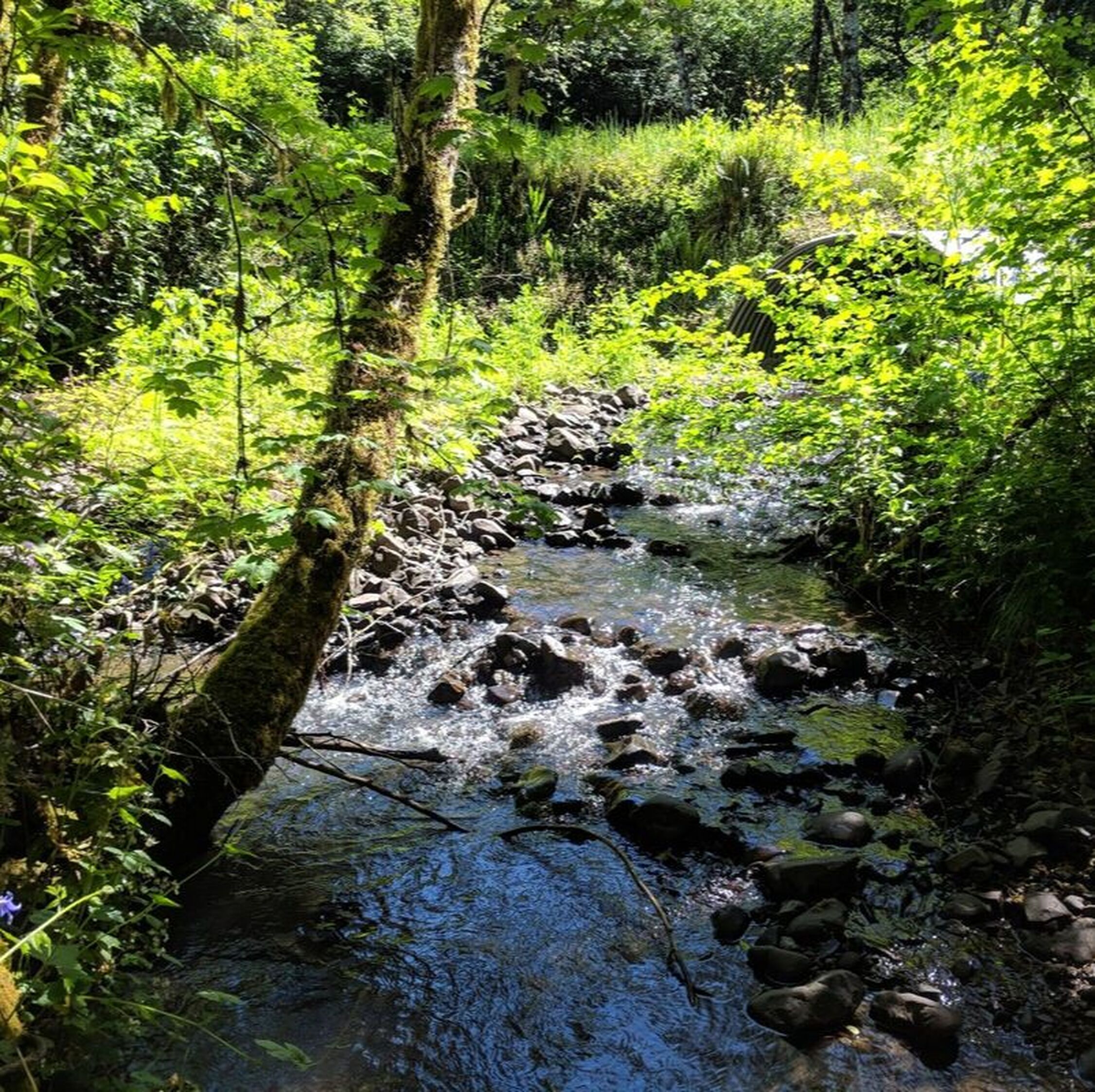
Luckiamute State Natural Area (LSNA) Floodplain Reconnection Project
The LWC, in partnership with Oregon Parks and Recreation Department (OPRD), has been working with River Design Group, Inc. (RDG) to provide technical assistance for floodplain enhancement projects at the Luckiamute State Natural Area (LSNA). The goal is to find opportunities to allow the Luckiamute River to be better connected with its surrounding floodplain. Click here to view and download RDG documents and related grant proposals.
Several funding entities have provided support to make this work possible. Thank you to the Oregon Watershed Enhancement Board's (OWEB) Special Investment Partnership, Meyer Memorial Trust's Willamette River Initiative and to the Bonneville Power Administration (BPA) for their support of this and other projects at LSNA.
Several funding entities have provided support to make this work possible. Thank you to the Oregon Watershed Enhancement Board's (OWEB) Special Investment Partnership, Meyer Memorial Trust's Willamette River Initiative and to the Bonneville Power Administration (BPA) for their support of this and other projects at LSNA.
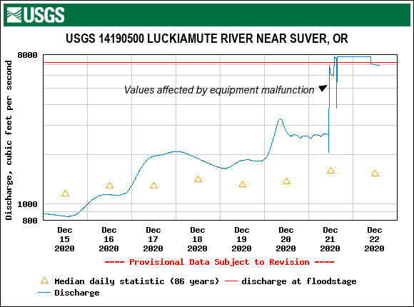
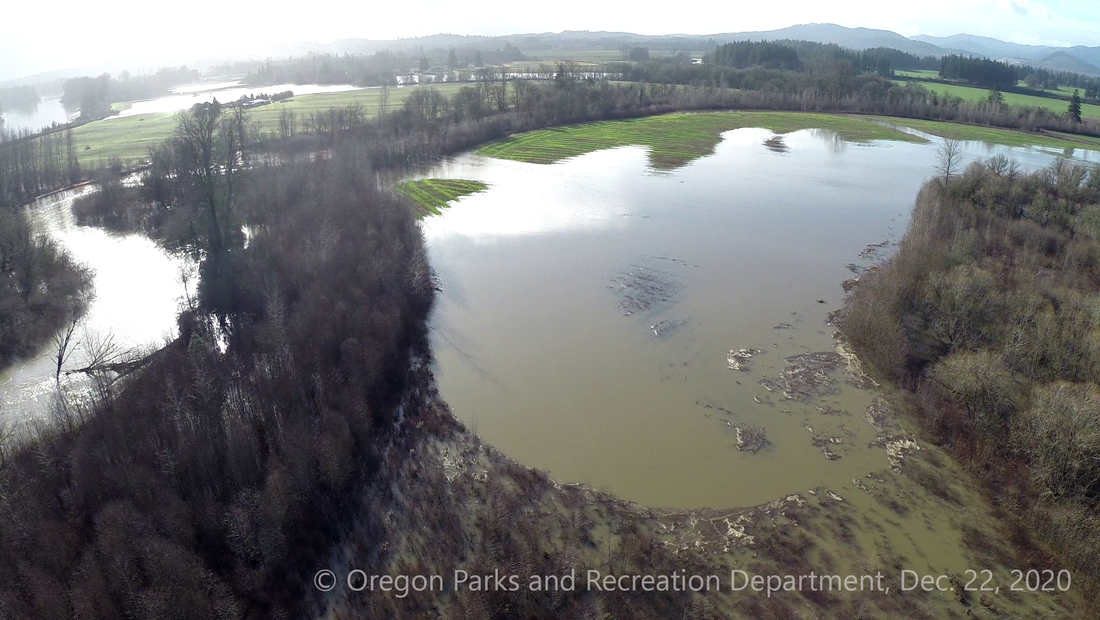
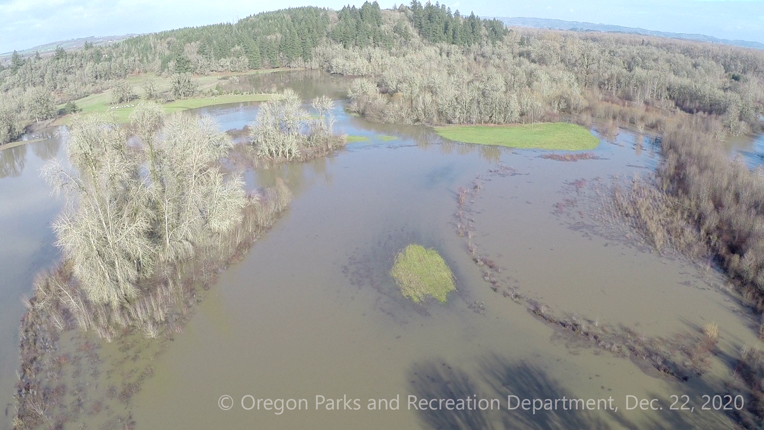
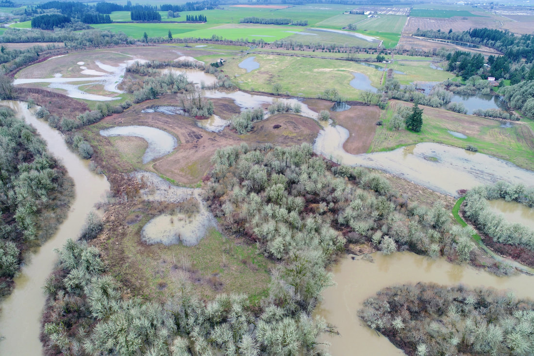
December 2020: Flooding at the Project Site!
On December 22, the Luckiamute River overtopped its banks and flooded into the newly created swales, channels and low-lying areas designed to reconnect the river with more of its historic floodplain habitat. Thanks to drone operator Brady Callahan from Oregon Parks and Recreation Department, we have some fascinating aerial footage of this exciting development!
|
Click here to view a webmap of GPS points showing the location of the elevations around the water's edge. Clicking on each point balloon will provide a pop-up with a photo and a link to the high-res version.
|
October 2020 Project Update
|
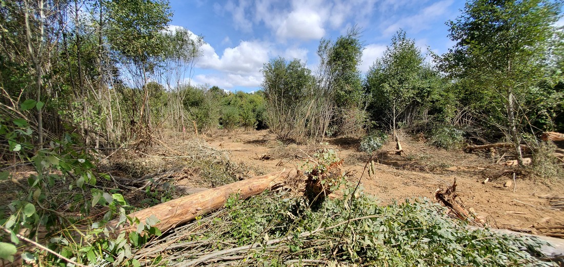
The earth-moving phase of our Luckiamute State Natural Area Floodplain Reconnection project has just been completed, expanding the value of this beautiful natural area for many species of fish and wildlife that rely on floodplain habitat for survival. When the fall rains and spring snowmelt raise the water level, our streams and rivers sometimes spill out onto their floodplains - which are the low-lying lands that surround each of our waterways. This natural cycle leaves behind rich topsoil, which makes the Willamette Valley excellent for agriculture. It also allows fish access to a rich source of nutrients and safe habitat during fast flows.
|
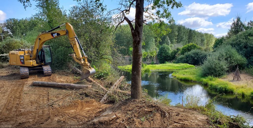
Trask Design and Construction contractors left "islands" of mature vegetation for habitat complexity in this excavated area that reconnects the Luckiamute River to its floodplain.
|
One of the outcomes of reconnecting the Luckiamute River to its floodplain will be improved habitat conditions for native fish and wildlife.
|
Many of our rivers however, including the Luckiamute, have been disconnected from their floodplains over the years. Dams and regulated flows, as well as berms, dykes, dredging, development and clearing of floodplain forests, are some of the many activities that have resulted in the loss of this valuable habitat. In turn, floodplain disconnection has led to accelerated streambank erosion, more severe flooding events, and is a major factor in the decline of our native salmon and trout populations.
|
|
How is a river reconnected to its floodplain? Guided by surveys of the existing topography and vegetation and plans by River Design Group, contractors from Trask Design and Construction, LLC raised and lowered the elevation of different areas of the landscape in a way that would allow the waters of the Luckiamute River to once again be able to spill out into the surrounding floodplain during annual flooding cycles. Some areas of high elevation were also lowered in order to allow floodwaters to fully recede back to the stream channel as water levels drop back down. This allows fish an exit path back to the Luckiamute River as water levels drop, and avoids the risk that they will be stranded in shallow pools. Trask crewmembers were able to carefully maneuver their heavy machinery around areas we had planted in the existing swales and wetlands, minimizing impact to these thriving native plant communities. Restoration crews from D. Franco Contracting, Inc. and our volunteers will also be planting this area and the surrounding land with native grasses, trees and shrubs.
|
This is an aerial view of the floodplain reconnection project site, taken by River Design Group, Inc., on February 22, 2017.
|
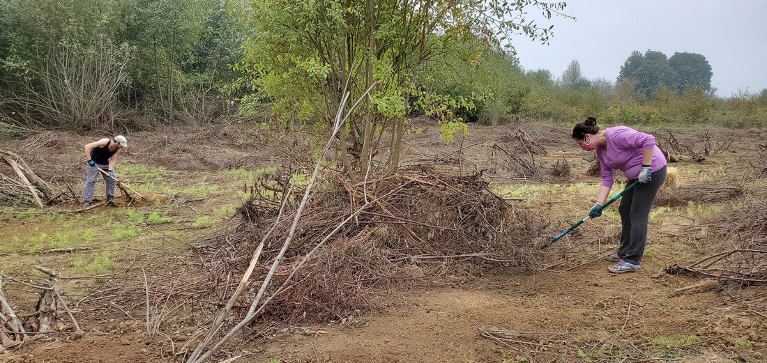
After earthmoving work was completed, volunteers helped seed the disturbed areas with native grass seed.
|
We have been taking plenty of photos and videos before and during the construction phase of the floodplain reconnection project, and will continue to document the changes to the river and its floodplain in the coming months. Ultimately, we will compile the footage into a project video, so that we can share this amazing transformation of a landscape with all of you. We also hope that we will be able to invite you to a project tour in 2021, so that you can see this ground-breaking project for yourself!
|
Below are some aerial photos of the LSNA floodplain reconnection sites. Photos by River Design Group, Inc., taken on February 22, 2017.
The information, data, or work presented herein was funded in part by the Bonneville Power Administration under Award Number 82741. The views and opinions of authors expressed herein do not necessarily state or reflect those of the United States Government or any agency thereof.
Click to upload Footer Background below