Luckiamute State Natural Area (LSNA) Enhancement
LSNA Wildlife
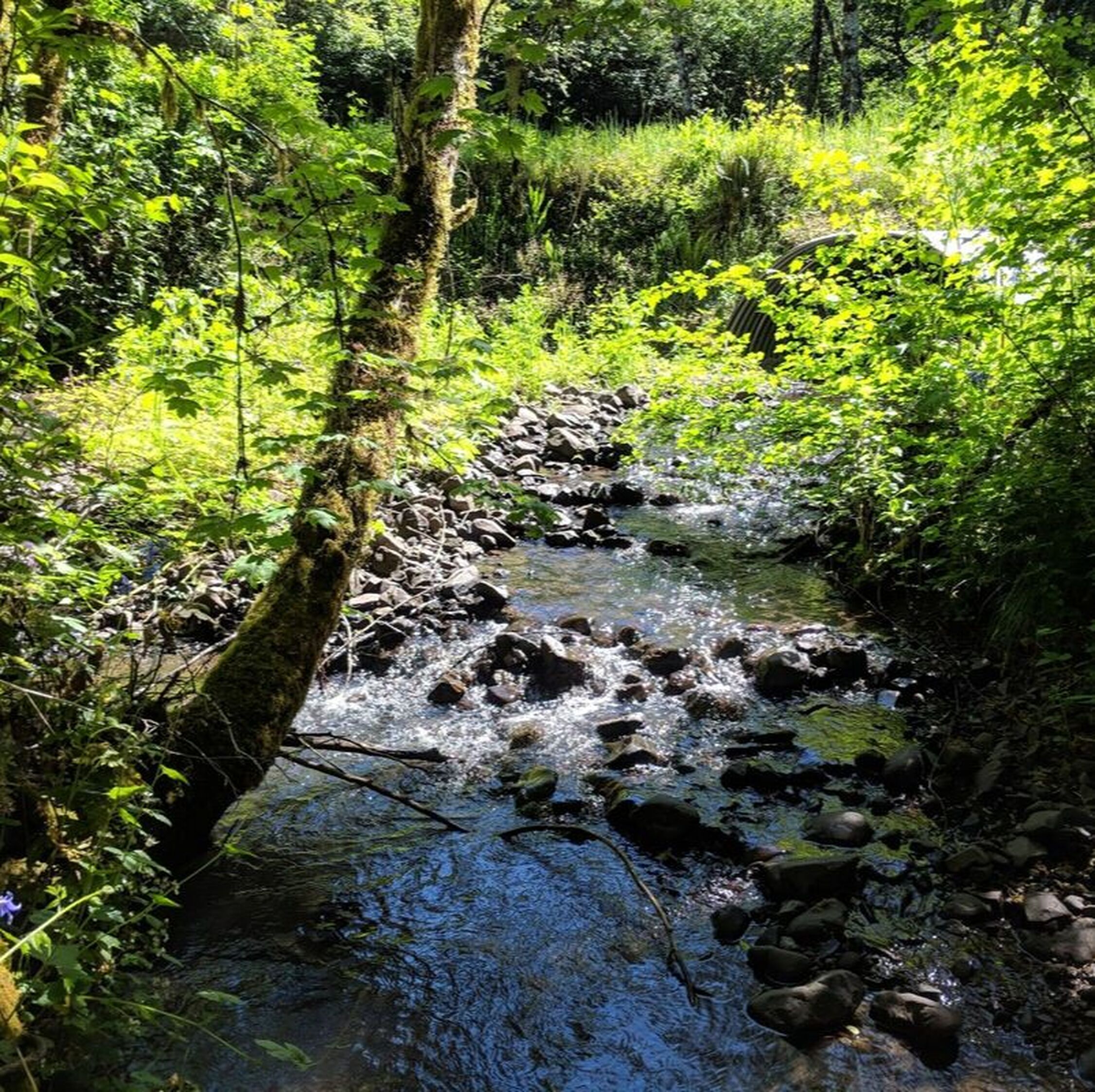
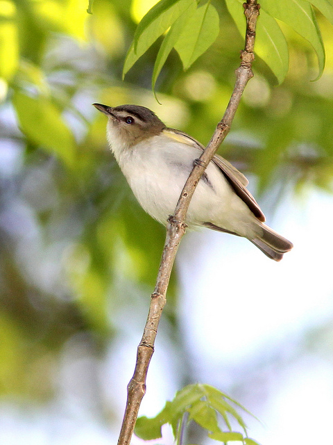
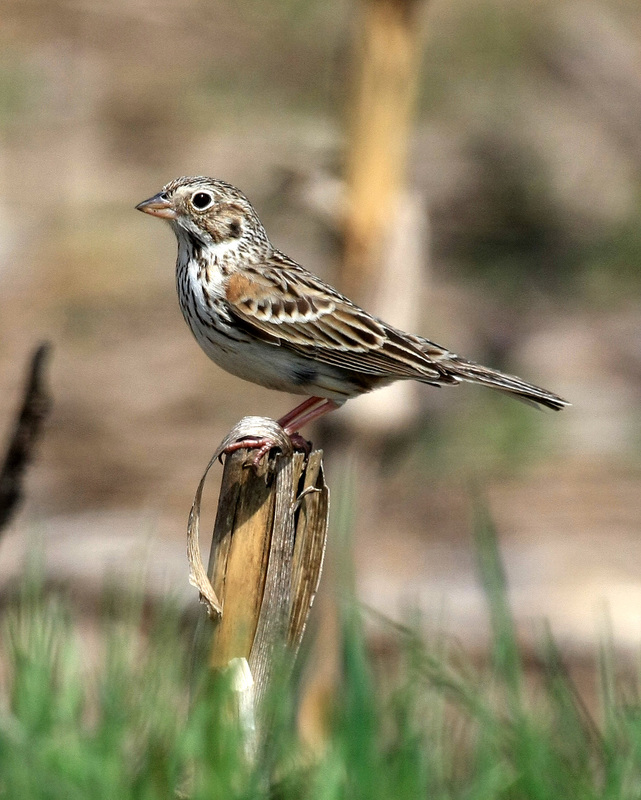
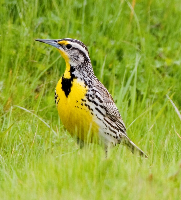
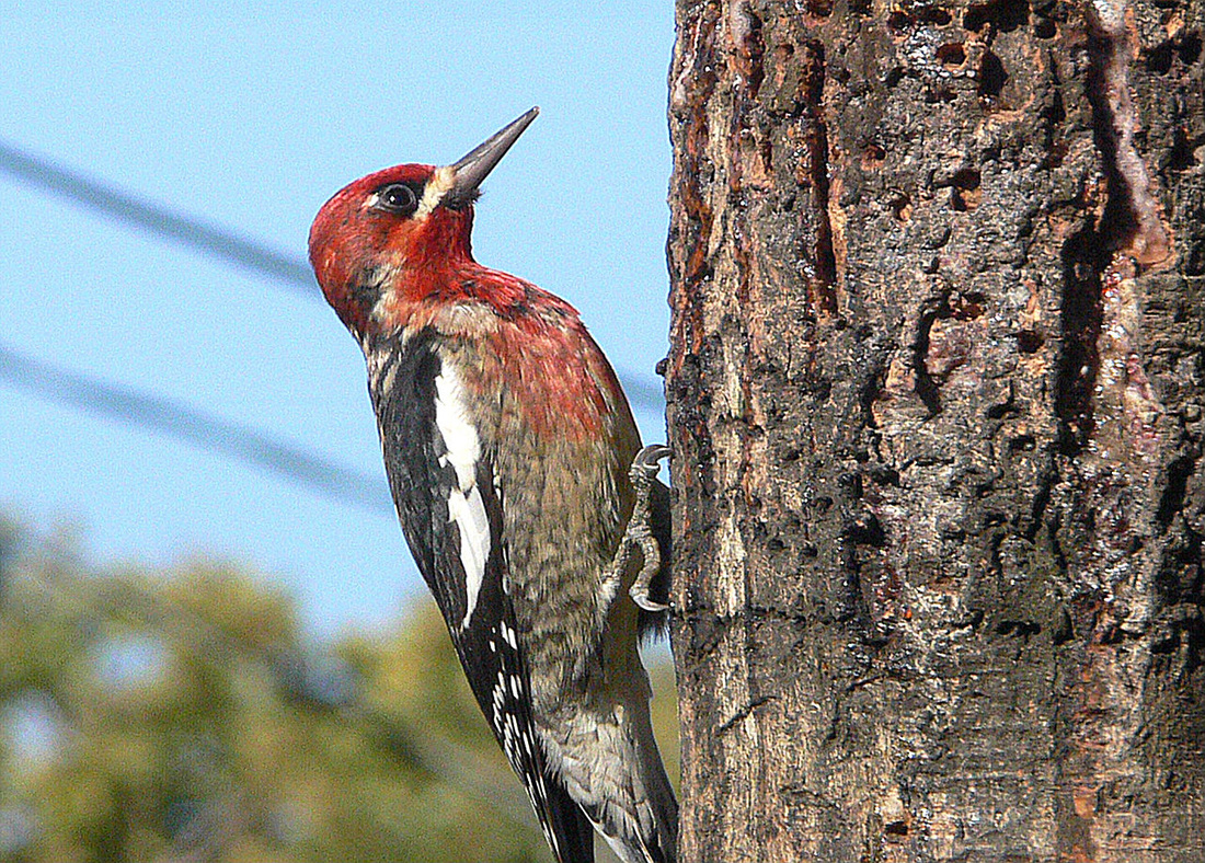
The North Unit of the Natural Area holds the largest remaining remnant of bottomland cottonwood-maple-ash gallery forest, which harbors nesting wood duck, ruffed grouse, Western screech-owl and five woodpecker species, as well as visiting red-eyed vireo and band-tailed pigeon populations. The grassland habitats of the North Unit are also a main attraction, with remarkable displays of wildflowers in the Spring. LSNA's grasslands were formerly a regular nesting site for Oregon vesper sparrow, a declining and increasingly rare subspecies endemic to the Willamette and Umpqua Valleys. Another threatened grassland species endemic to this region, streaked horned larks, can still be found within two miles of LSNA. Western meadowlarks are regular in winter but have effectively disappeared as a nesting species, in recent decades.
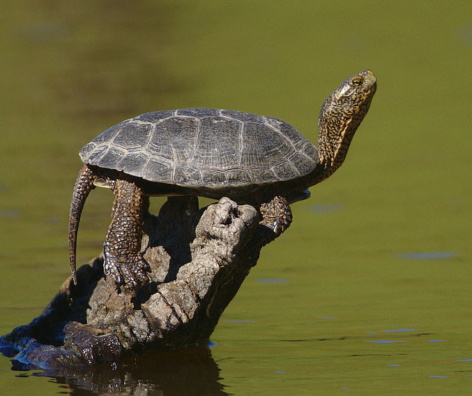
The South Unit is best known for its population of Western Pond Turtles, a species in decline due to habitat loss. These dark greenish brown turtles are thriving in a pond that used to be a gravel quarry, located about half-a-mile from the South Unit trailhead. Future plans for the area involve construction of a trail that takes hikers around the pond to viewing stations where they can catch a glimpse of these elusive reptiles in action. As you venture into the oak prairie habitat in the upland areas, be on the lookout for white-breasted nuthatch and Western bluebirds.
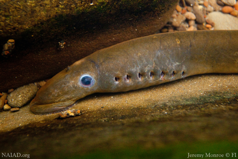
Of course the Willamette and Luckiamute Rivers are important for fish too! During heavy rain events when the rivers spill over their banks, the floodplains of LSNA provide important rearing and feeding habitat for Spring Chinook and Winter steelhead - both of which are threatened species. Pacific lamprey and the recently de-listed Oregon chub are also found in these waters, and are part of the incredibly rich species diversity that makes LSNA so unique.
The South Unit is best known for its population of Western Pond Turtles, a species in decline due to habitat loss. These dark greenish brown turtles are thriving in a pond that used to be a gravel quarry, located about half-a-mile from the South Unit trailhead. Future plans for the area involve construction of a trail that takes hikers around the pond to viewing stations where they can catch a glimpse of these elusive reptiles in action. As you venture into the oak prairie habitat in the upland areas, be on the lookout for white-breasted nuthatch and Western bluebirds.
Of course the Willamette and Luckiamute Rivers are important for fish too! During heavy rain events when the rivers spill over their banks, the floodplains of LSNA provide important rearing and feeding habitat for Spring Chinook and Winter steelhead - both of which are threatened species. Pacific lamprey and the recently de-listed Oregon chub are also found in these waters, and are part of the incredibly rich species diversity that makes LSNA so unique.


Geocaching at LSNA
Geocaching is a great way to explore your watershed, and a fun activity for the whole family! Using a set of clues, a map, and/or GPS coordinates, you can experience the delight that comes from finding a hidden treasure and recording your name in the cache logbook. Just remember to always bring some 'booty' to leave behind for the next geocacher!
- Reid's Wood Duck Box (LSNA North)
- Luckiamute Camp 108 (LSNA North)
- Ladybug @ Luckiamute South (LSNA South)
Visiting LSNA
In the spring and fall, we often host Bird Walks guided by local bird expert and naturalist, Joel Geier, as well as staff-led tours that highlight our ongoing restoration work. Make sure you get on our mailing list to stay informed about all of our upcoming events!
|
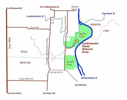
Directions
From downtown Albany: Go over Hwy 20 westbound bridge and, immediately after the bridge, turn right onto Spring Hill Drive. Follow Spring Hill Drive. After about 7 miles, turn right onto Buena Vista Road. You will see State Park signs that say "South Luckiamute" about 1/3 mile from Spring Hill on the right, and "North Luckiamute" about 1.5 miles from Spring Hill, also on the right. Directions to find the North Unit Trailhead are included below. From Corvallis: Go north on Hwy 99W about 9 miles to Camp Adair Rd (by the landfill, north of Adair Village). Turn right (east) onto Camp Adair Rd. and go 2 miles to T-intersection at Independence Hwy. Turn left (north) and go 1 mile, then turn right on Spring Hill Drive and go east for another mile to Buena Vista Rd where you will see State Park signs for "South Luckiamute" about 1/3 mile from Spring Hill on the right, then “North Luckiamute” about a mile further, also on the right. Then follow directions below find the North Unit Trailhead. |
From Monmouth: Go south on Hwy 99W for 7 miles to flashing yellow light at Airlie/Suver Rd. Turn left (east) on Suver Rd and go 2 miles to T-intersection at Corvallis Rd. Turn right (south) and go 2 miles, then turn left on Spring Hill Drive and go east for another mile to Buena Vista Rd. Turn left (north) and look for a State Park sign for “South Luckiamute” on the right. About a mile further north will be a State Park sign for "North Luckiamute," also on the right. Directions to find the North Unit Trailhead are included below.
From Independence: Go south on Main St., which turns to Corvallis Road. Continue about a mile, and turn left (east) on Buena Vista Rd. Follow Buena Vista Rd. for about 9 miles, making sure to pay attention to the intersections where you must turn in order to stay on Buena Vista Rd. As you approach 9 miles, you will see State Park signs for “North Luckiamute," and about a mile further on, for "South Luckiamute." Directions to find the North Unit Trailhead are included below.
To find the North Unit Trailhead: Watch for a sign for “North Luckiamute” access road, just before Buena Vista Rd. crosses bridge over the Luckiamute River. Turn east onto access road which immediately goes over a wooden timber bridge, then turns into a paved road along the south bank of the Luckiamute River. Where the pavement ends, bear left (northeast) at fork with private driveway, and continue about 200 yards to a gravel parking area.