|
Just Released:
|
Below is a 5-minute project video that explains the reason for this project and how
South Fork Pedee Creek is being restored to health! |
South Fork Pedee Creek Enhancement
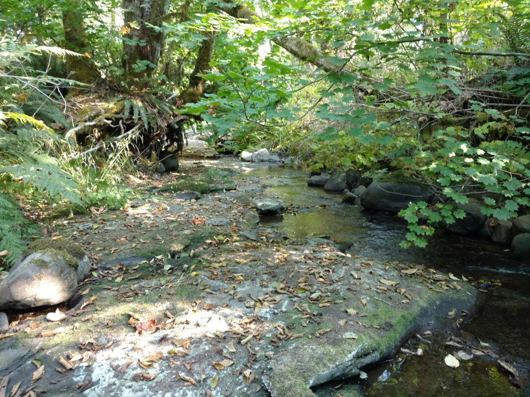
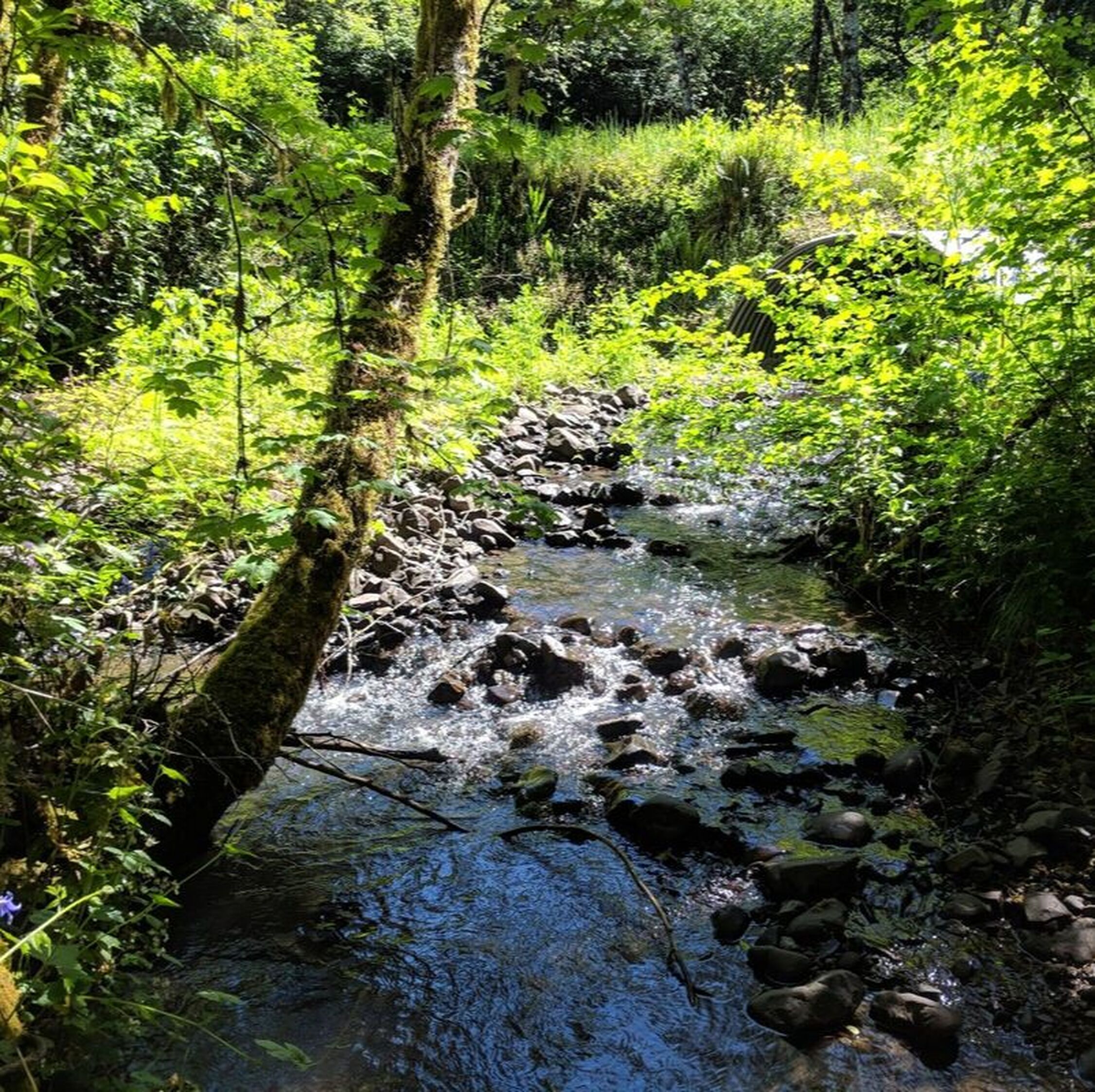
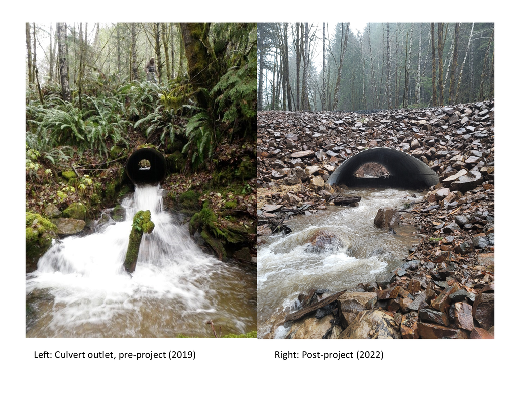
Below the lower culvert, the streambed of SF Pedee Creek was reduced to mostly bedrock and lacked the habitat features such as gravel bars, pools, and riffles that are important for native fish and other aquatic species.
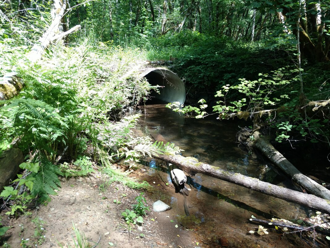
Undersized culverts were not only preventing gravels from being transported downstream, they were a barrier to young salmonids trying to access upstream habitat.
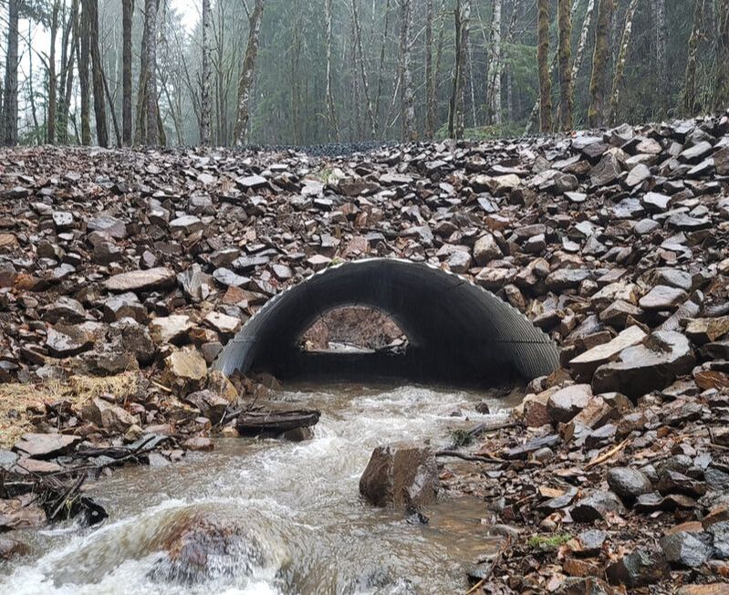
The new bottomless arch culvert that was installed allows fish to access upstream habitat and spawning gravels to be transported downstream.
About 5 acres of riparian (streamside) habitat have undergone invasive species control, and were planted with native trees and shrubs.
|
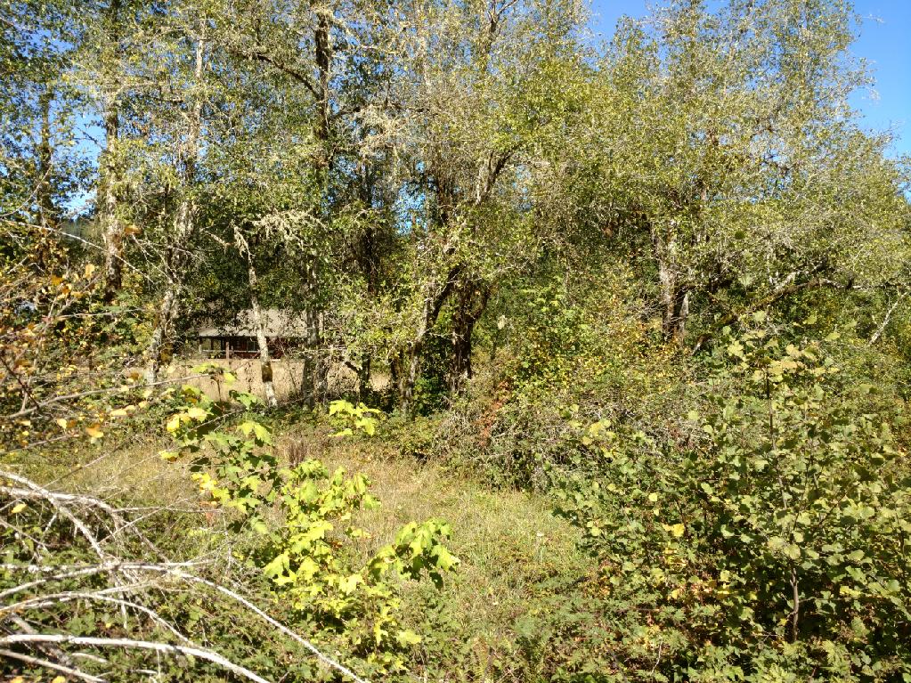
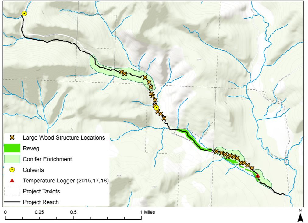
Starting in a patchwork of forested timberlands in southern Polk County, South Fork Pedee Creek (SF Pedee) winds its way for several miles before joining with mainstem Pedee Creek, a tributary to the Luckiamute River. Like many upper Luckiamute streams, Pedee Creek was significantly impacted by historical practices such as logging to the water’s edge, log removal, log drives, and installation of undersized culverts at road crossings. Although these practices are no longer used, their legacy has resulted in a streambed that was scoured to bedrock in many areas, a loss of logjam habitat in the stream channel, eroded streambanks, and an absence of conifers in the riparian (streamside) area. In addition, a portion of the riparian forest was dominated by invasive species and not providing adequate shade. Two undersized culverts impacted the ability of fish to move through the stream. The uppermost culvert was also holding back valuable gravels that fish need for spawning. The South Fork Pedee Enhancement project includes several activities to address each of these issues. These activities have now been completed or are underway. The LWC and our partners continue to monitor changes in South Fork Pedee Creek.
• Installed 319 logs in 22 log structures along 2.1 miles: Built log structures are designed to mimic naturally-occurring log jams, which occur when streamside trees fall into the water. These log piles help slow the flow of a river, allowing gravels to accumulate - which improves water quality, and provides habitat and nutrients for many aquatic species. • Replaced two undersized culverts: Project partners Starker Forests, Inc. and Manulife Investment Management (formerly Hancock Forest Management) replaced the lower culvert with a bridge in 2019. In October 2022, the BLM and LWC led a project to replace the upper culvert with a bottomless arch culvert. As a result of this work, spawning gravels are now being transported downstream and young salmon and trout can now access over a mile of additional habitat upstream of the culvert. • Improving streamside forests: Planted 1,200 conifers to begin growing the large wood of the future, control invasive species where needed on about 5 acres, and planted native trees and shrubs to establish healthy streamside forest. Plant establishment weed control is ongoing to help native plants reach a “free-to-grow” state. • Community Outreach: Project tours, volunteer plantings and regular project updates will provide community members opportunities to stay informed about project activities and the long-term benefits to the watershed. Sign-up for LWC’s emails to get project updates or become a Friend of the LWC so you can hear about our behind-the-scenes project tours! • Monitoring: Data collection including changes in the stream channel, stream temperature, and macroinvertebrate (aquatic insect) populations. A big thank you goes to the Oregon Watershed Enhancement Board (OWEB) for the $121,684 grant that made Phase 1 of this restoration project possible. The Bureau of Land Management (BLM) through a funding partnership with OWEB, provided the funding for the upper culvert replacement (Phase 2) along with contributions from Manulife Investment Management. The invaluable project management services for many years of this project were provided by Bonneville Environmental Foundation ecologist, Jean-Paul Zagarola. The project is now managed by LWC Restoration Project Manager, Ross Hiatt. Additionally, the LWC is working in partnership with several organizations to accomplish these project goals — including Starker Forests, Inc., Manulife Investment Management, Forests Forever, Inc., Western Oregon University, and BLM. We have also partnered with local students enrolled in the Falls City High School Career and Technical Education (CTE) program, who participated in volunteer and job-training activities at the project site. |
In addition to the project partners and funders, there were many local businesses and contractors who contributed their hard work and expertise, and without whom this project would not have been successful. Below is a list of local or regional family-owned businesses involved in the project in some way (in no particular order):
- Starker Forests (landowner, partner, project contributor, based out of Corvallis)
- D Franco Contracting, Inc. (reforestation services, based out of Salem)
- Kuznetsov Thinning Company (reforestation services, based out of Woodburn)
- Trask Design and Construction (upper culvert replacement, based out of Corvallis)
- McGee Engineering (bridge design, based out of Corvallis)
- Mike Adams Construction Company (bridge installation and large wood placement, based out of Stayton)
- Forslund Crane Services (bridge installation, based out of Albany)
- V. Van Dyke Inc. (trucking company that specializes in hauling long beams, based out of Tacoma)
|
Overview of Project Area

|
South Fork Pedee Creek Enhancement Project Activities
|
Click to upload Footer Background below