Luckiamute State Natural Area (LSNA) Enhancement
Exploring LSNA

Detail of the Willamette River from a lidar data image, showing the Luckiamute River (left) and the Santiam River (right) joining it. (Oregon Department of Geology and Mineral Industries)
|
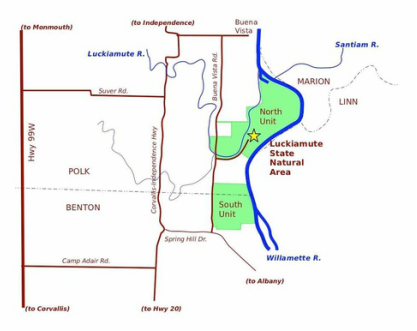
Luckiamute State Natural Area (LSNA) straddles the Benton/Polk County line along the Willamette River. At the boat-in campground at the northern end of LSNA is a spectacular view of the convergence of three rivers: the Luckiamute River, the Santiam River and the mighty Willamette River. Looking downstream from this vantage point, you can see the Santiam empty its waters into the Willamette. Then just a stone's throw downriver of this confluence is where the waters of the Luckiamute and Willamette Rivers are joined. According to Oregon State University (OSU) research, this intermingling of three of the area's most important rivers hosts the second-most diverse fish population in the Willamette Valley (the McKenzie-Willamette confluence tops the list). Formerly known as Luckiamute Landing, LSNA has grown from a collection of small parcels along the Willamette River to a 925-acre Natural Area managed as a single entity by Oregon Parks and Recreation Department (OPRD). LSNA is divided into two sections, the 615-acre North Unit, which includes a seasonal boat-in campground, and the smaller 310-acre South Unit.
|
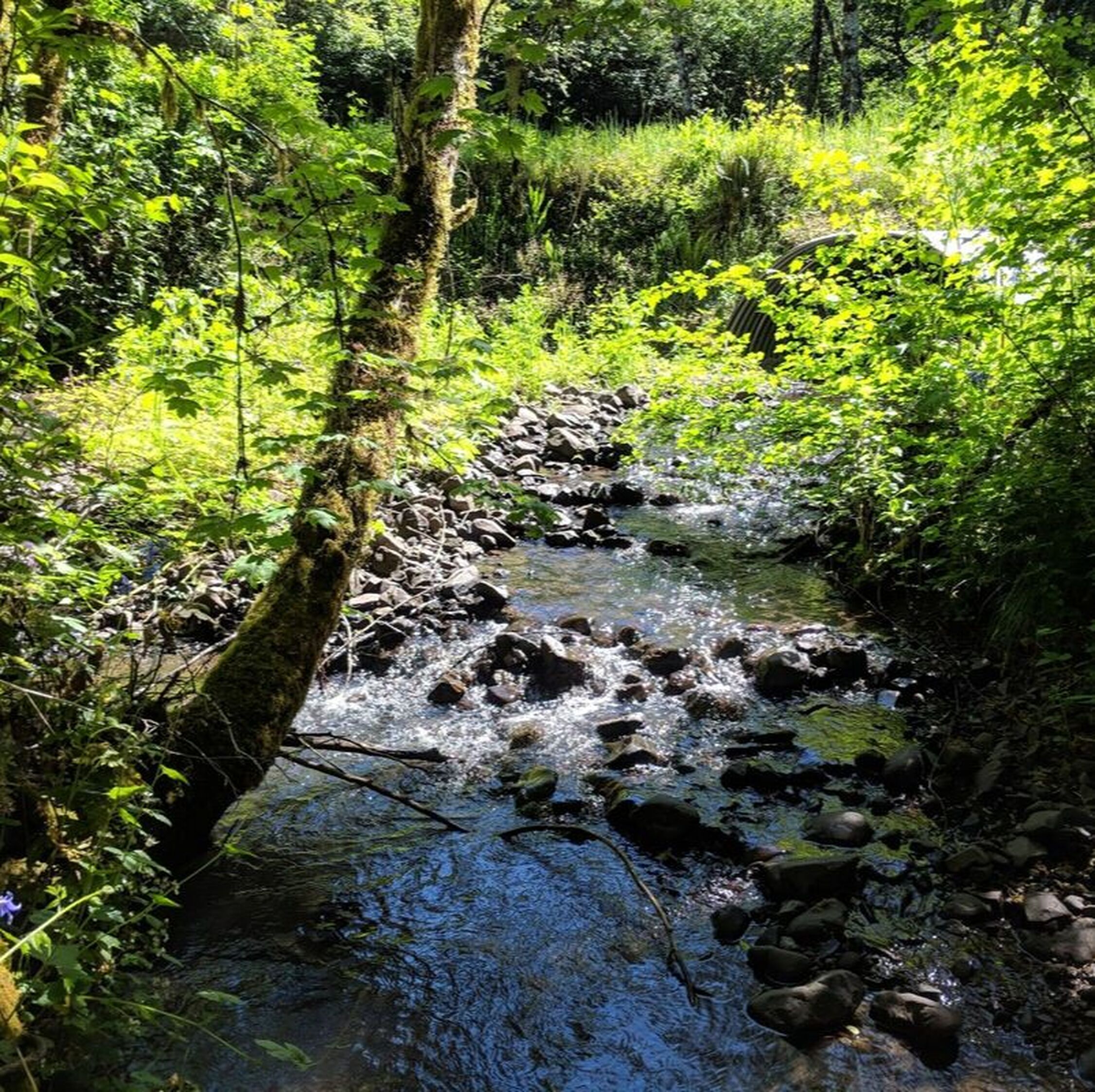
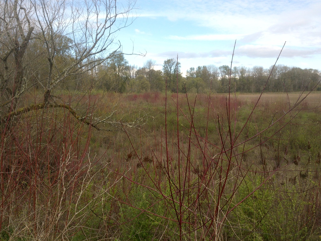
Perhaps LSNA is best known for its large remnant of deciduous "gallery forest" -- a forest of majestic cottonwoods and maples arching high over an exceptionally diverse understory. These increasingly rare habitats are critical to the survival of many kinds of neo-tropical migratory birds, as well as a wide variety of waterfowl, shorebirds, amphibians, and turtles. Less well known is that about a third of the Natural Area – and much more of the surrounding neighborhood – was historically grassland (prairie and oak savanna), which has become the Willamette Valley's most threatened habitat type. Efforts to restore these rare ecosystems have resulted in a 5-acre demonstration prairie in LSNA's North Unit, as well as protected oak savanna habitat in the South Unit.
Click here to view the wildlife of LSNA.
Click here to view the wildlife of LSNA.
Teaming Up to Restore Willamette Floodplain Conditions
Luckiamute State Natural Area Enhancement is a project of the Oregon Parks and Recreation Department (OPRD) and the Luckiamute Watershed Council, with funding and technical support from Oregon Watershed Enhancement Board (OWEB), Meyer Memorial Trust, Bonneville Environmental Foundation, and Bonneville Power Administration, under the Willamette Special Investments Partnership (SIP) program. The partnership has made substantial progress toward improving site conditions and building community support around LSNA. The primary goal has been to reduce invasive weeds, replant with native shrubs and then continue to manage those native plantings until they can thrive and spread on their own. Most of the 80-acre Phase I acreage had previously been planted and had an established overstory of ponderosa pine, Douglas fir, Western red cedar and cottonwood. However, the understory had not developed and was dominated by Himalayan blackberry, river tansy, common teasel and a host of common agricultural weeds. Thanks to the Council and its partners, this area now has a multi-layered canopy, with a diverse mix of native trees, shrubs and forbs that provide food and shelter for a wide array of birds and other wildlife.
Luckiamute State Natural Area (LSNA) Enhancement
Click and drag the slider below to see the increase in riparian (streamside) habitat along the Luckiamute River from 2010 to 2018!
 July, 2018
 July, 2010
|
(Above) Keep your eye on the Luckiamute River (flowing down the middle of the image), and then move the slider all the way to the right. This is the view in July 2010 before planting activities started. Now, slide the image all the way to the left to change the view to July 2018. See the increase in vegetation along the left side of the river? Over eight years, there has been a dramatic increase in riparian (streamside) habitat that will better provide food and shelter for LSNA's birds and wildlife. And as the trees and shrubs grow, their shade will help keep summer water temperatures cooler -- which will benefit steelhead, Chinook salmon and other aquatic life.
(Below) Here is an aerial photo of the same area featured in the slider, taken in February 2017. The natural process of the river overtopping its banks and flowing into its floodplain (the surrounding low-lying land) has many beneficial impacts, including improved wildlife habitat, floodwater storage, and groundwater recharge. |
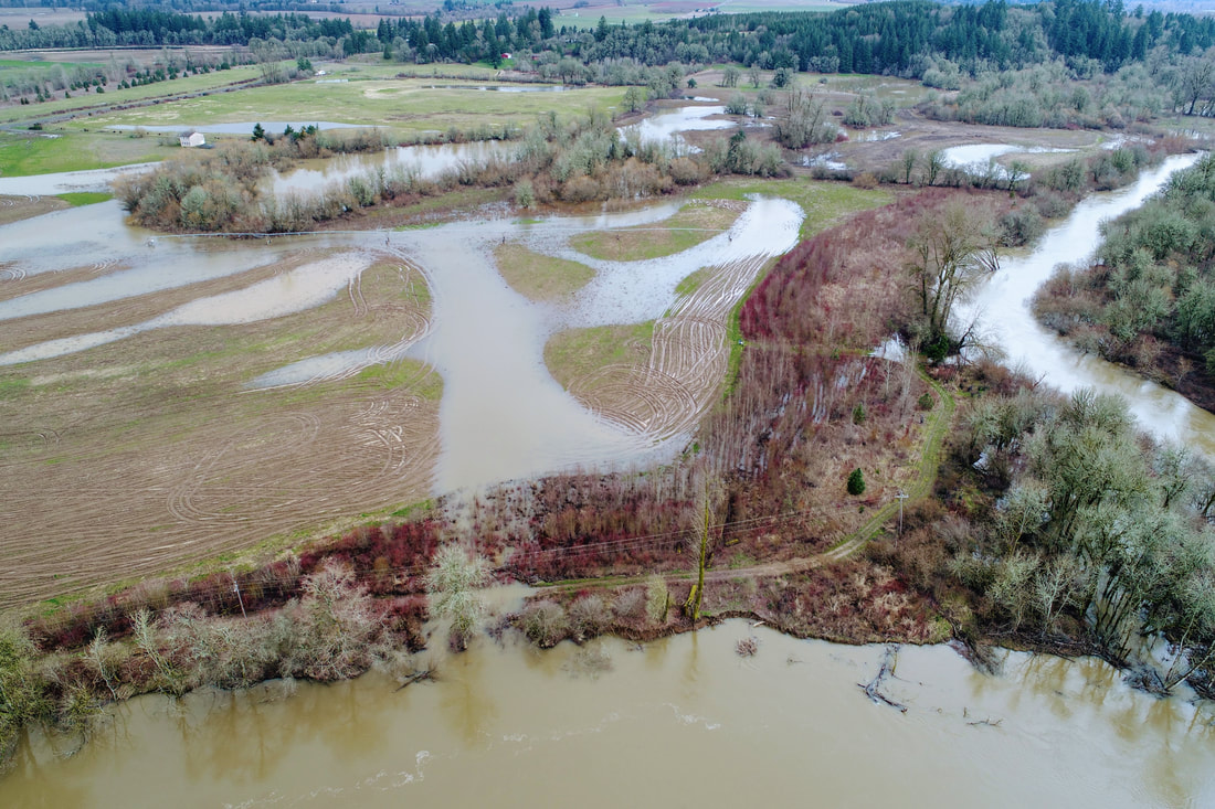
Photo Credit: River Design Group with support from Bonneville Power Administration, Feb 2017
Click here to learn more about floodplain reconnection project planning at LSNA.
LSNA Project Details
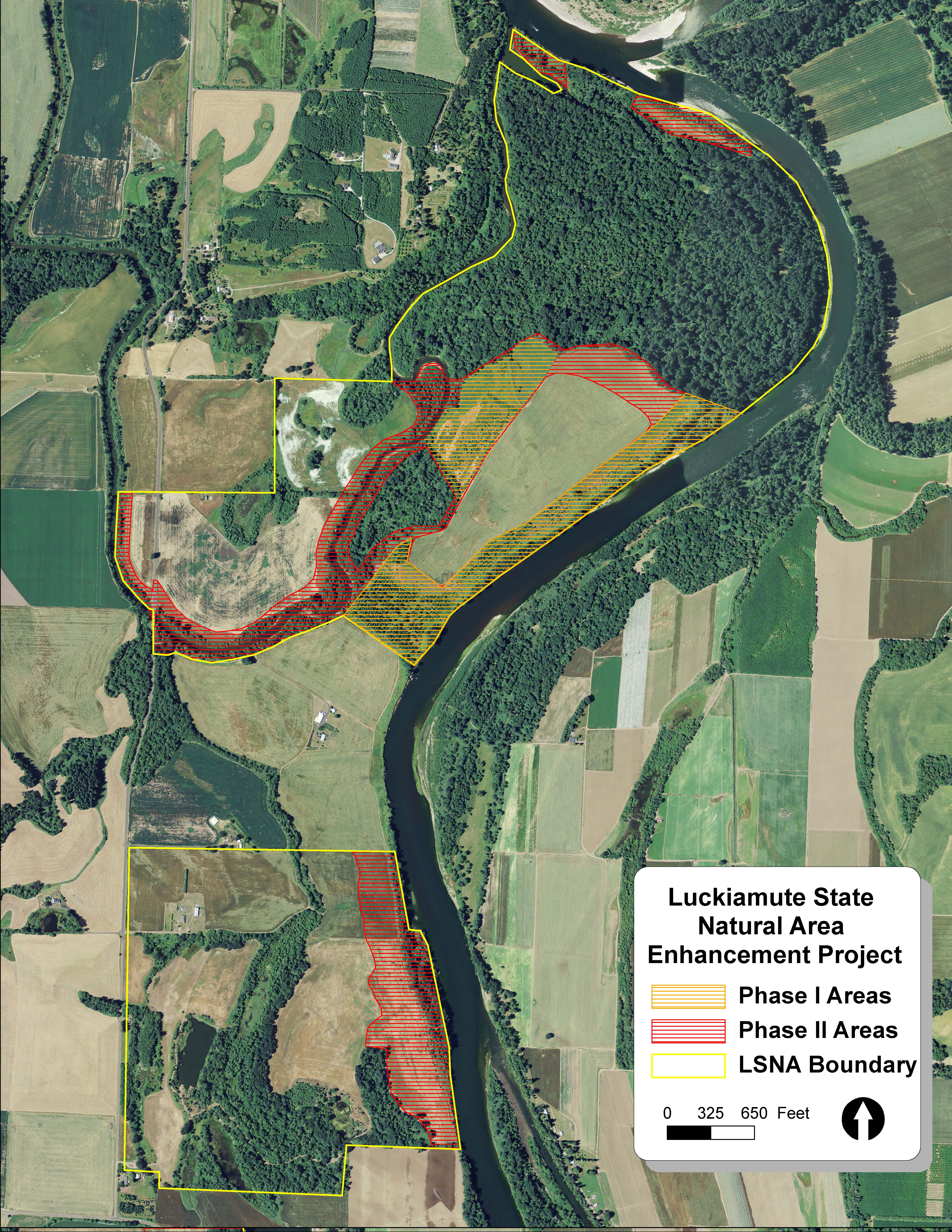
LSNA Phase I & II - North and South Tracts
Phases I and II
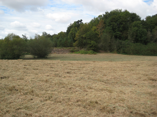
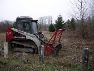
Phase I of the LSNA Restoration Project began in 2011, and included mowing, cutting, strategic weed treatments to prepare the site for planting. In 2012, contracted revegetation crews planted over 122,000 native trees and shrubs on 80 acres of riparian (streamside) forest and wetland habitat. Phase II added 137 acres of riparian and wetland habitat in 2013 and 2014, expanding the total project area to a total of 217 acres. During both Phases, a total of 420,000 native trees and shrubs of 30 different species were planted in both the North and South Units of LSNA. |
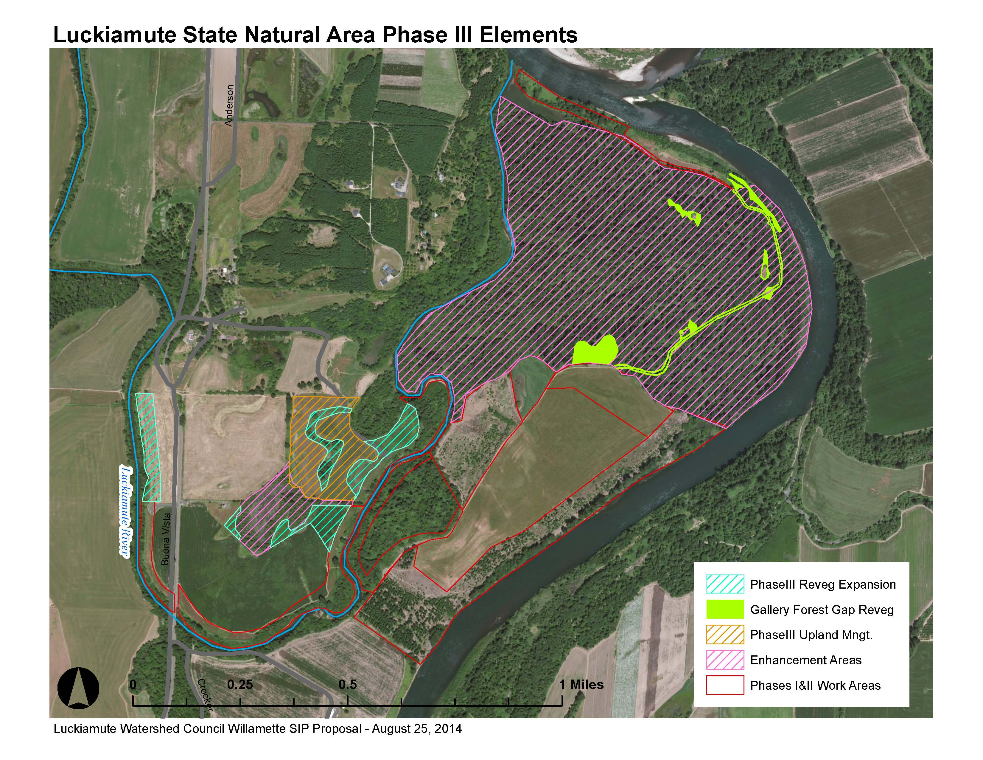
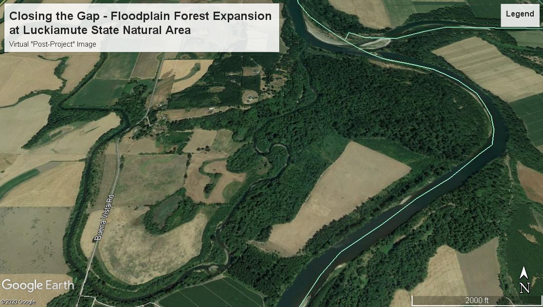
LSNA Phase III - North Tract
Phase III
Phase III of the LSNA Restoration Project includes 117 additional acres of riparian and floodplain forest in the North Unit of LSNA. The LSNA's gallery forest represents one of the largest remaining tracts of this unique habitat type that is becoming increasingly rare in the Willamette Valley. The goal of Phase III has been to fill gaps in the canopy within the gallery forest, and help protect it from increasing weed pressures. Currently, project partners are stewarding and managing a total of 535 acres of riparian forest and wetland habitat. |
Phase IV - Floodplain Reconnection and Reforestation
Phase IV involved a combination of revegetation and earth moving to enhance or recreate connection points between the Luckiamute River and the floodplain. Click here to learn more about this project phase.
Phase IV involved a combination of revegetation and earth moving to enhance or recreate connection points between the Luckiamute River and the floodplain. Click here to learn more about this project phase.
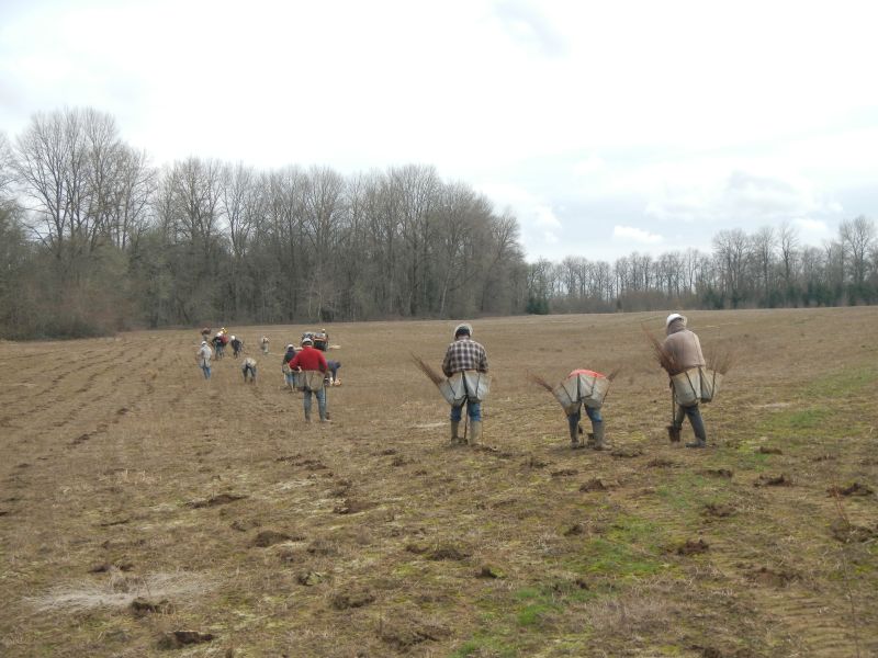
In February 2013, reforestation crews planted 14 acres in LSNA's North Tract to expand the gallery forest, a unique type of forested riparian (streamside) habitat that is becoming increasingly rare in the Willamette Valley.
|
In the spring of 2013, targeted applications of herbicide protect the growing plants and reduce weed competition for the growing season.
|
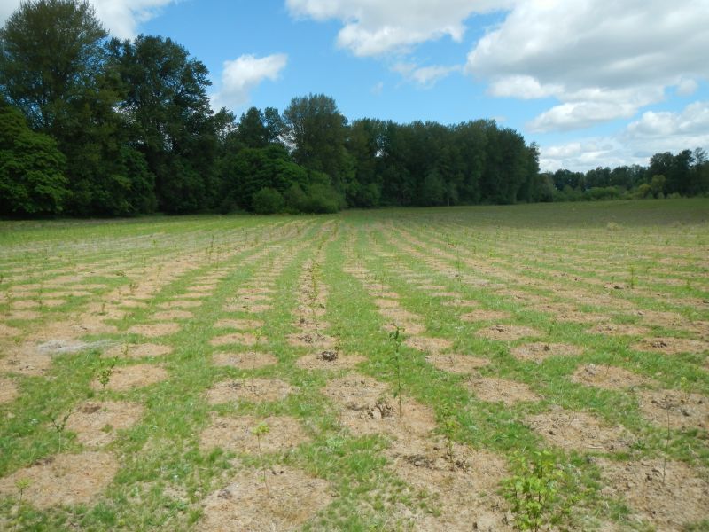
The following spring, in 2014, you can see how much the new plants have already grown!
|
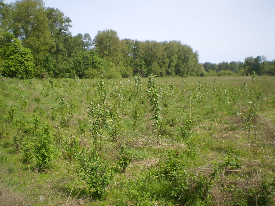
In Fall 2019, you can see how much that line of newly planted cottonwood trees has grown!
|
Aerial view of the 60-acre formerly-leased field within LSNA North Unit. Note the large tract of gallery
forest bordering the north side of the field.
|
A view of the LSNA North Unit field with gallery forest cottonwoods in the background.
|
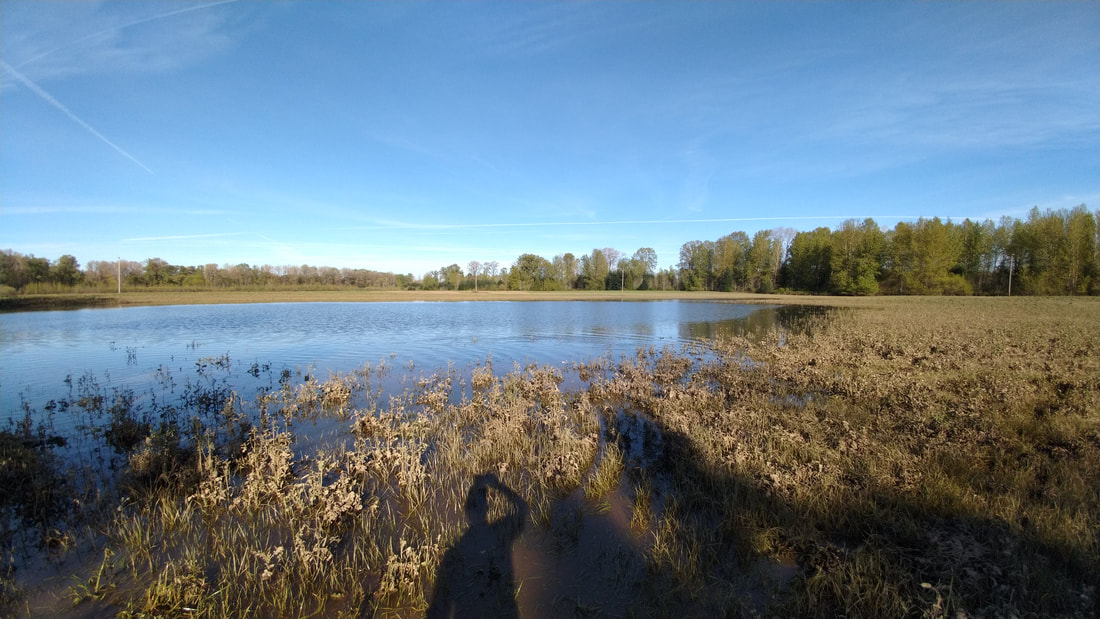
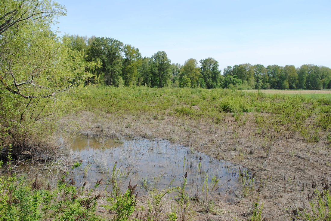
Several acres of standing water at LSNA North Unit two weeks after 2019
Willamette flooding. Frequent flooding here provides salmonids access to nutrient-rich floodplain habitat.
|
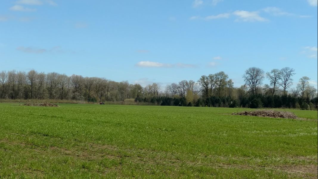
Phase V
Phase V of the LSNA Restoration Project began in 2020, and is focused on the reforestation of a 60-acre, formerly leased farm field that sits in the middle of LSNA's North Unit Loop Trail. Thanks to funding from , Meyer Memorial Trust (MMT), Bonneville Power Administration (BPA), and PGE Habitat Fund, these 60 acres are about to be re-incorporated into the surrounding gallery forest that grows between the north edge of the loop trail and the Luckiamute River. Crewmembers from D. Franco Contracting planted 158,000 native trees and shrubs in January 2022, and will continue stewarding this area for years to come with invasive weed treatments and inter-planting as needed.
Read more about the LSNA Phase V Project in our Winter 2021-2022 Newsletter!
Work Continues at LSNA
Since 2011, work at Luckiamute State Natural Area has focused on restoring and reconnecting the floodplain habitat in and around the park. The large remnant of riparian forest found within LSNA has been identified as a high conservation priority and is critical to supporting the native fish and wildlife diversity that depends on these ecosystems for their survival. Opportunities for volunteers at LSNA and other projects in the watershed are available at the "Get Involved" link here or on the menu above.
Mowed reed canary grass prior to planting (2011).
The wetland area of the North Tract in April 2014
|
Blackberry cutting (2011)
This is the same wetland area about one year later, in March 2015
|
|
Directions
From downtown Albany: Go over Hwy 20 westbound bridge and, immediately after the bridge, turn right onto Spring Hill Drive. Follow Spring Hill Drive. After about 7 miles, turn right onto Buena Vista Road. You will see State Park signs that say "South Luckiamute" about 1/3 mile from Spring Hill on the right, and "North Luckiamute" about 1.5 miles from Spring Hill, also on the right. Directions to find the North Unit Trailhead are included below. From Corvallis: Go north on Hwy 99W about 9 miles to Camp Adair Rd (by the landfill, north of Adair Village). Turn right (east) onto Camp Adair Rd. and go 2 miles to T-intersection at Independence Hwy. Turn left (north) and go 1 mile, then turn right on Spring Hill Drive and go east for another mile to Buena Vista Rd where you will see State Park signs for "South Luckiamute" about 1/3 mile from Spring Hill on the right, then “North Luckiamute” about a mile further, also on the right. Then follow directions below find the North Unit Trailhead. |
From Monmouth: Go south on Hwy 99W for 7 miles to flashing yellow light at Airlie/Suver Rd. Turn left (east) on Suver Rd and go 2 miles to T-intersection at Corvallis Rd. Turn right (south) and go 2 miles, then turn left on Spring Hill Drive and go east for another mile to Buena Vista Rd. Turn left (north) and look for a State Park sign for “South Luckiamute” on the right. About a mile further north will be a State Park sign for "North Luckiamute," also on the right. Directions to find the North Unit Trailhead are included below.
From Independence: Go south on Main St., which turns to Corvallis Road. Continue about a mile, and turn left (east) on Buena Vista Rd. Follow Buena Vista Rd. for about 9 miles, making sure to pay attention to the intersections where you must turn in order to stay on Buena Vista Rd. As you approach 9 miles, you will see State Park signs for “North Luckiamute," and about a mile further on, for "South Luckiamute." Directions to find the North Unit Trailhead are included below.
To find the North Unit Trailhead: Watch for a sign for “North Luckiamute” access road, just before Buena Vista Rd. crosses bridge over the Luckiamute River. Turn east onto access road which immediately goes over a wooden timber bridge, then turns into a paved road along the south bank of the Luckiamute River. Where the pavement ends, bear left (northeast) at fork with private driveway, and continue about 200 yards to a gravel parking area.
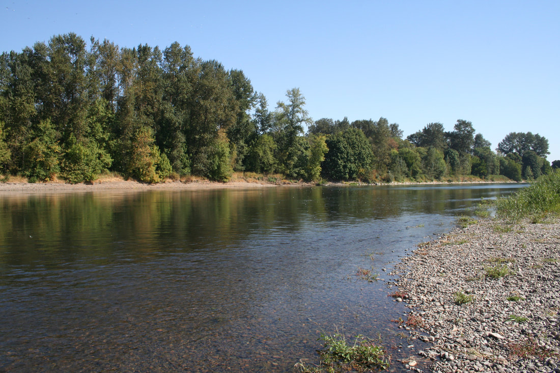
The Willamette River near the confluence with the Luckiamute and Santiam Rivers (photo courtesy of OPRD)
|

Ranger Steve DeGoey leading a tour of LSNA (by Suzanne Teller)
|
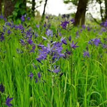
Camas lilies (Cammassia quamash) are a common sight in the wet meadow habitats of LSNA.
|
Click to upload Footer Background below