|
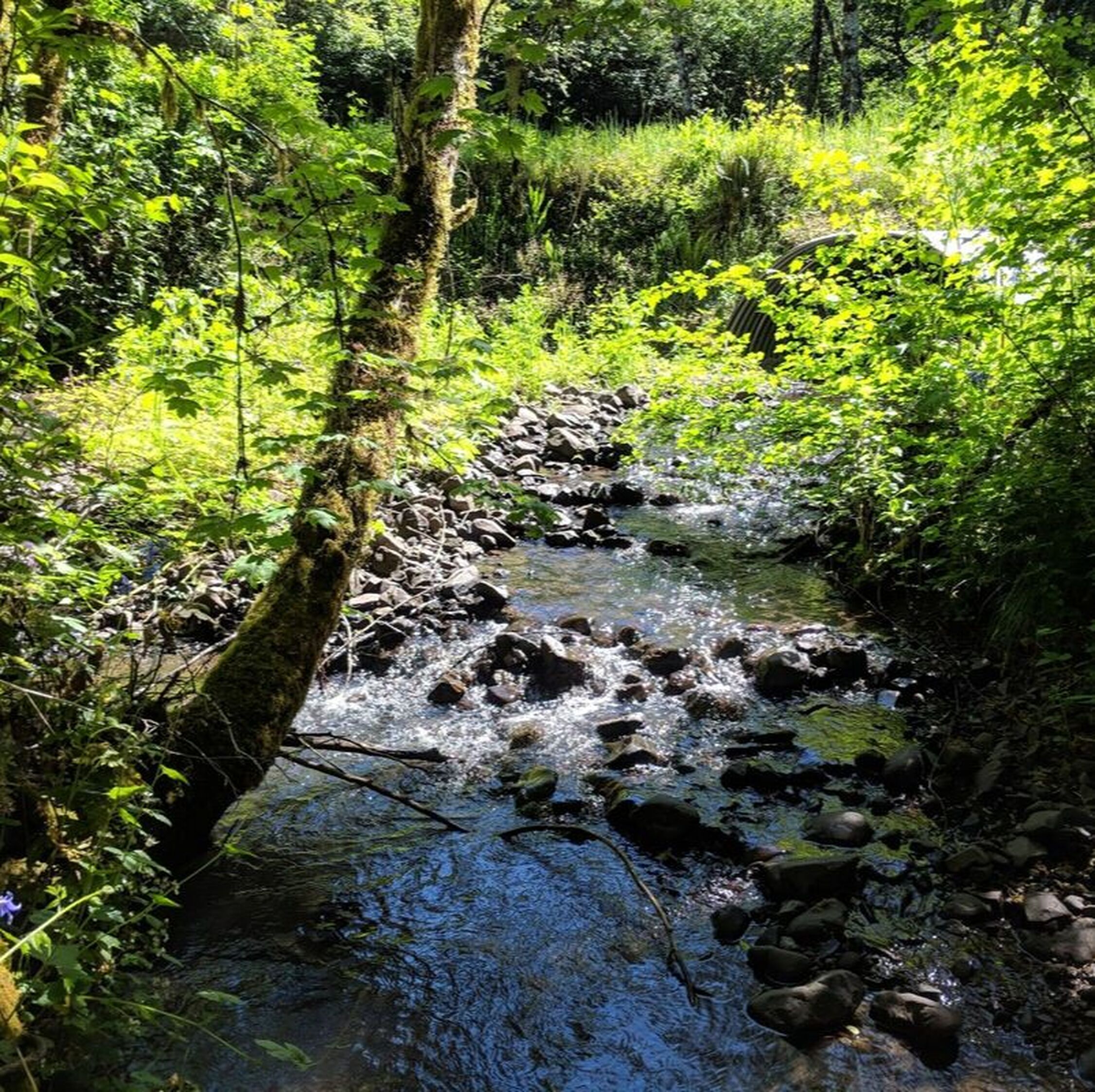
This time of year, it is hard to know what to expect weather-wise when you venture outside. So, I came prepared for the Luckiamute State Natural Area (LSNA) Fall Tour last Sunday for all kinds of precipitation and temperature changes. Arriving at the North Tract entrance at 9:30am, I changed into my waterproof hiking boots, pulled on a fleece, a hooded jacket, and added a pair of gloves for good measure. I was ready for anything! The first tour participants arrived just before 10:00am, as did the LSNA Park Ranger, Steve DeGoey, and several more cars rolled up soon after. By then, it was pretty clear that we had picked a perfect day for a tour through what has come to be one of my most favorite nature walks in the area. It was an especially exciting day for me, as I got to unveil the three new interpretive panels that the Luckiamute Watershed Council (LWC) and Oregon Parks and Recreation Department (OPRD) have completed as an important outreach component of the LSNA Enhancement Project. Since 2012, the LWC and OPRD, with support from the Oregon Watershed Enhancement Board, Bonneville Power Administration and Meyer Memorial Trust, have been enhancing and restoring some of the unique landscapes found within LSNA. 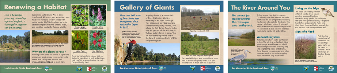 Sneak peak of the new interpretive panels to be installed at LSNA in November! What makes Luckiamute State Natural Area so special? Well for starters, it is the site where three spectacular rivers come together as one. Standing at the confluence -- where the Luckiamute and Santiam Rivers empty their waters into the Willamette -- is an experience that can only be described as magical. I had only learned the week before, from OPRD Archaeologist Nancy Nelson, that the Luckiamute Indians had used the confluence area as prime summer fishing grounds. Not surprising really when you consider that, next to the McKenzie River confluence about 70 miles or so upstream, this spot has the most diversity of fish species in the Willamette Valley. 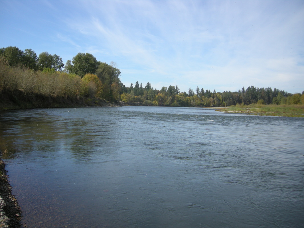 Standing just upstream of the confluence where the Luckiamute and Santiam Rivers meet the Willamette. Another unique spot at LSNA is the gallery forest. According to Ranger DeGoey, OPRD has ranked this stretch of riparian forest at LSNA at a Level 2, just a step below a Level 1 rating -- which is reserved for those landscapes considered 'pristine' and without human alteration. What also makes this forest particularly special is that it is the largest intact gallery forest left standing in the entire Willamette Valley. All of our tour participants opted to add an extra hour to our stroll to deviate off the main loop trail and walk through the gallery forest down to the boater's campground at the confluence. By this time, I was shedding layers as the sun grew stronger and the morning mists cleared away. As we walked, we spoke of the beauty and serenity of the landscape -- most of the participants had never ventured inside the borders of the park, and some hadn't ever heard of this gem located practically in their backyard. 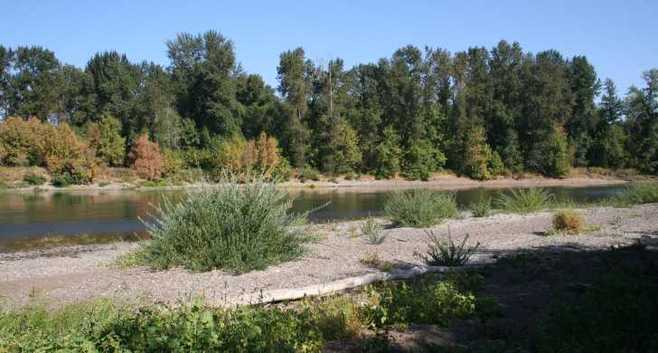 The term 'gallery forest' refers to a forest that forms as a corridor along rivers in an otherwise open landscape. Rounding the final curve of the loop trail took us past a broad swath of floodplain habitat, which is inundated every year during the heavier winter and spring rains. Previously covered by a monoculture of invasive reed canary grass, this area is now a vibrant and diverse landscape of red osier dogwood, wild rose and willow. Camas seed banks that had lain dormant beneath reed canary grass have since awakened and now bloom every spring, painting the wetlands with a haze of purple. For now, however, the colors are muted. The trees and shrubs are slipping into their annual dormancy as they prepare for the coming rains and dark, cold days of winter. As we hiked the final stretch of the trail back to the parking lot, nobody minded that the tour had taken three hours to complete instead of the two we had scheduled. In fact, everyone was talking about the next time they would visit LSNA to witness its continuing transformation. I encourage those of you that have not yet ventured into this precious little corner of our watershed to also take the time to stroll through the lanscapes of LSNA. I'll look forward to seeing you there!
1 Comment
|
Suzanne TellerHi, I'm the Outreach Coordinator for the LWC. Make sure to visit often for updates and stories from our work in the watershed! Archives
February 2016
Categories |
 RSS Feed
Click to upload Footer Background below